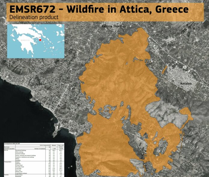
Some 3,472 hectares (34,724 stremmas) were destroyed by the wildfire that broke out on Monday at Kouvaras, in Southeast Attica, and which spread to the East Attica areas of Lagonissi, Saronida and Anavissos.
This satellite data was provided by the European Union’s Copernicus Emergency Management Service – Mapping agency, that was activated by order of Vassilis Papageorgiou, Secretary General of the Greek Civil Protection General Secretariat’s Directorate of Emergency Response & Planning.
It is noted that the Copernicus/Emergency Management Service – Mapping service of the European Union has also been activated for the areas in Western Attica-Boeotia and Corinthia (Loutraki) which have been affected by forest fires since July 17. Mapping data and products resulting from the analysis of satellite images for these areas are expected immediately as the requests have been accepted by the European Union.


